AMR Technology: Obstacle Avoidance​ and Mapping

AMR Technology

OBSTACLE AVOIDANCE: RELIABLE AND SAFE NAVIGATION FOR AMRS

Autonomous Mobile Robots (AMRs) use maps of your warehouse to find their way around, but maps like these only include obstacles that are permanent or semi-permanent, like walls and shelves. There’s a lot going on in your warehouse every day that isn’t included on these maps, ranging from boxes and pallets, to workstations that move around occasionally, to obstacles that are in constant motion, like forklifts or people. These are all obstacles that your AMRs will have to both reliably detect and safely avoid.

The primary navigation sensor that most AMRs use is LiDAR— a laser that’s able to detect objects out to a distance of several tens of meters, usually with a very wide field of view. LiDAR offers very long range and very high accuracy, but on most AMRs, it only operates in a single fixed plane, meaning that it can see a narrow slice of the world at approximately the height of your shins, but nothing above or below that. For navigating, this isn’t much of a problem, but it can make obstacle avoidance difficult because the LiDAR can’t see obstacles that are close to the ground (like pallets or feet) or anything that’s hanging above the ground. To take just one example, a LiDAR sensor would have no trouble detecting the four legs of a table, but it would have no way of detecting the top of the table, and might try to pass underneath while carrying a load. Obstacles like these can pose a risk for AMRs that use only LiDAR for obstacle avoidance. You can view videos here and here.


Obstacle detection is only half of the obstacle avoidance problem: once the AMR recognizes an obstacle, it needs to make the correct decision about what to do next. For obstacles that aren’t moving, this isn’t very difficult, and most AMRs have no trouble planning a safe path around them. However, when an AMR detects a moving obstacle, like a forklift, the problem becomes more complicated, because treating a moving obstacle like a static obstacle could lead to a collision. The robot needs to understand where the forklift is headed, making an intelligent prediction about its motion in order to avoid it effectively.


No matter how many sensors an AMR has, or how well it’s able to avoid static and dynamic obstacles, there will always be situations that prove to be particularly challenging for an autonomous robot. For example, some sensors may at times be blocked by one obstacle, preventing the AMR from detecting a different obstacle. It’s critical that the AMR be able to handle situations like these, by properly assessing what it does and doesn’t know about the environment around it and reacting safely when it’s missing information.


Avoiding obstacles is one of the things that makes autonomous mobile robots so much more versatile and valuable than the previous generation of autonomous ground vehicles: rather than having to adjust your workflow around the robots, investing in the right AMR means that you can have the confidence that your robots will be able to robustly adapt to your existing warehouse environment. Make sure that you carefully evaluate your AMR options, and that the AMR you choose has the hardware and software necessary to make navigating your warehouse both reliable and safe.

MAPPING: HOW DOES MY AMR KNOW WHERE TO GO?

Fetch Robotics- Mapping- Blog post 4

In order for a fleet of autonomous mobile robots (AMRs) to find their way around your warehouse, they need something that shows them where they are and where they need to go. Creating and maintaining this map is one of the most important parts of any AMR deployment, and understanding how this process works will help you decide what kind of AMR system is right for you.

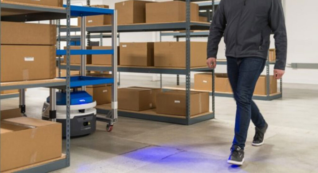
Most AMRs use lidar sensors as their primary means of visualizing the world. Lidars are lasers that, in most indoor navigation applications, scan across a wide field of view in a plane just above ankle height. For the purposes of understanding where they are in your warehouse, this means most AMRs can only see a two dimensional slice of the world: anything on the floor, or above your knees, is effectively invisible to their lidar sensors. The map that AMRs use to navigate is essentially an image of how every part of your warehouse looks from the perspective of your shins.

To figure out exactly where it is, an AMR looks at the location and orientation of objects that its lidar sensor can see and matches them with the location and orientation of objects on its map. The lidar is precise enough that AMRs can detect that they’re in one specific aisle, even if your warehouse has hundreds of aisles that are arranged identically. AMRs can also use other tricks to keep track of their location, such as counting the number of rotations of each of their wheels to estimate how far they’ve traveled and in which direction. This helps AMRs deal with situations where what they see with their lidar sensors doesn’t match anything on the map. This can happen if there are a lot of people or vehicles moving around or many objects on the floor. Different AMRs deal with this potential confusion in different ways, and having a system that’s responsive to the ongoing changes in your warehouse will help keep things running smoothly.


Of course, a robust AMR depends heavily on the quality of its map. Making this map is a critical task for any company selling AMR systems, and there are a variety of different approaches, each with advantages and limitations. Some companies will need to spend a substantial amount of time making a map, and it may involve shutting down your operation while they do so. Other companies are able to quickly make maps using the same AMRs that will be working for you. Frequently, there are restrictions on how much space a single map can cover. You’ll want to make sure that your entire warehouse can be covered by a single map. In this way, you can deploy AMRs anywhere you need them without having to worry about which map they’re using.


There are other important considerations as well: for example, how easy is it to expand a map to keep up with your growing business? What happens if you want to move things around? The AMRs may need to be assigned to travel on different routes, or to go between different workstations, or to charge themselves in different areas. Ideally, these are changes that you’ll be able to make yourself, using simple online tools.


When it’s working properly, mapping is something that you shouldn’t have to think about: your AMRs will just be where you need them, when you need them. Getting to this point, with robust AMRs and a high quality, versatile map, will require a substantial amount of experience and technical expertise from your AMR manufacturer.